Our latest installment in the Art Desk series offers readers a look at the process behind charting and illustrating the map of Alagaësia, from its snow-capped mountains and lush forests to its diverse cities. Since 2003, the map has been readers’ constant companion as they navigate their way through the land alongside Eragon, Roran, and Nasuada.
The Evolution of a Map
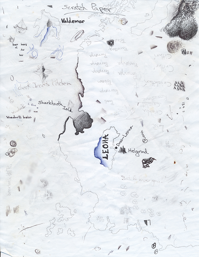
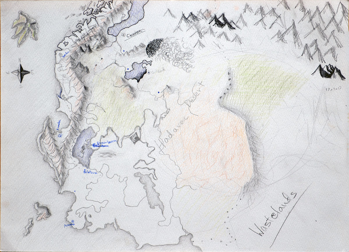
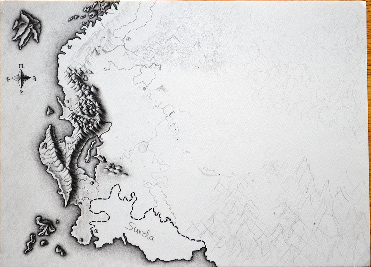
There are several key differences between initial concepts and the final map. Towns and villages were moved, renamed, or disappeared altogether. Rivers wound throughout the Empire, connecting many towns and cities. A modest Hadarac Desert formerly bordered the “Wastelands,” an ominous area that would eventually become the dwarves’ iconic Beor Mountains. Du Weldenvarden, sanctuary of the elves, only appeared in later versions. Throughout the world’s many iterations, the continent’s coast and nearby Vroengard Island remained the sole permanent fixtures.
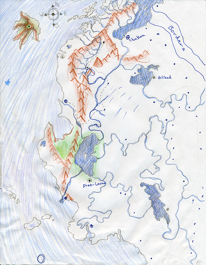
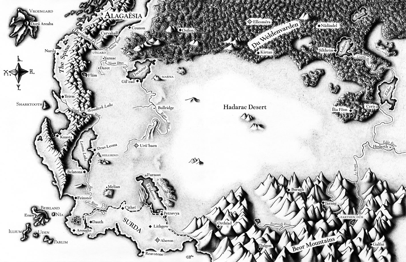
Final map in hand, many fans now wonder: what lies beyond the familiar borders of the land of Alagaësia?